US Deletes Map Showing PoK and Aksai Chin After Trade Deal Announcement
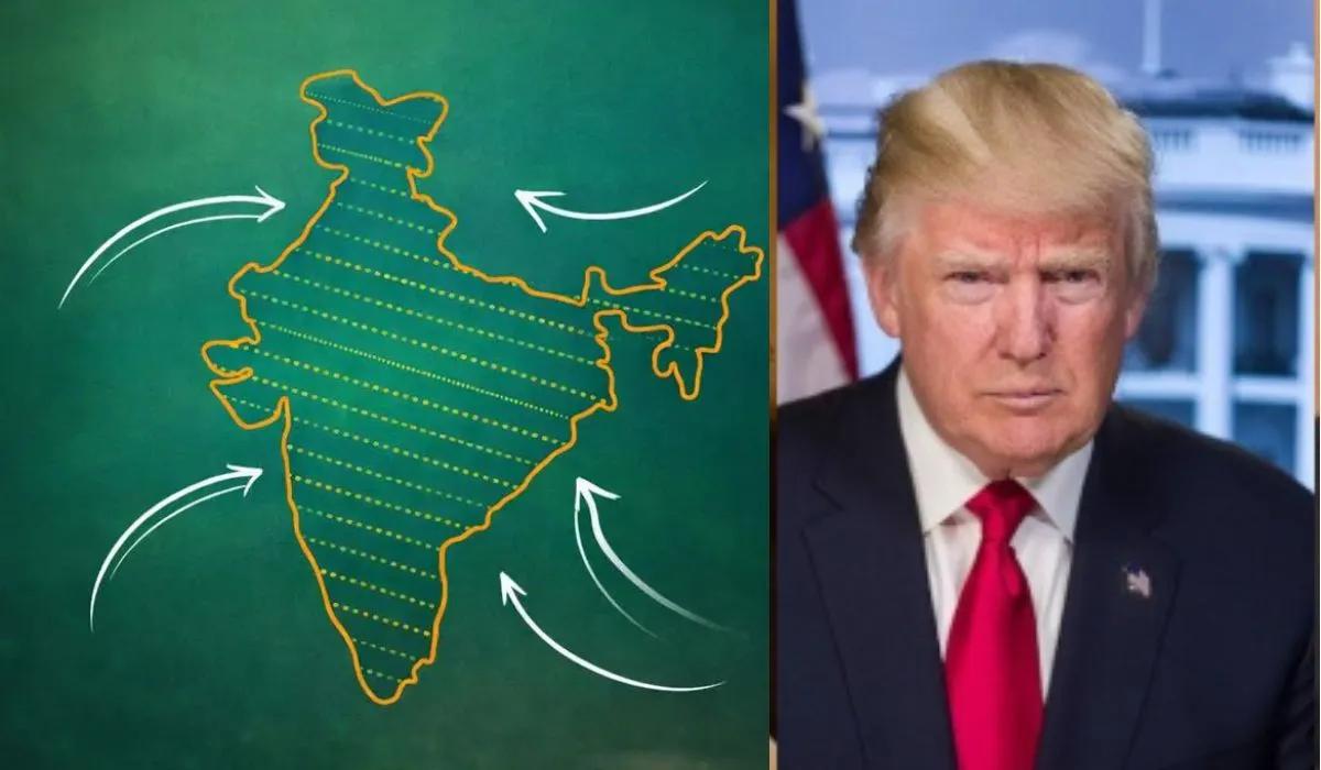
In a surprising diplomatic turn in February 2026, the **United States Trade Representative (USTR) office quietly removed a social media post that featured a map of India showing both Pakistan-occupied Kashmir (PoK) and Aksai Chin as part of Indian territory. The map had been posted alongside the announcement of an interim India-US trade framework agreement, prompting widespread debate about whether Washington was signalling a major shift in its longstanding cartographic and diplomatic approach to sensitive territorial disputes in South Asia.
The original map shared on the USTR’s official X account drew attention because it portrayed the entire region of Jammu and Kashmir, including Pakistan-administered areas and China-claimed Aksai Chin, as integral parts of India’s territory without the usual dotted or dashed lines that most U.S. agencies use to denote disputed regions. This was seen as a noteworthy departure from traditional U.S. map depictions and sparked intense discussions among political analysts, diplomats, and the public.
A Departure from Historical U.S. Cartographic Practice
Historically, U.S. government maps, including those used by the State Department and federal agencies, have shown PoK and Aksai Chin as disputed territories, using neutral markers or separate demarcations to reflect the competing claims by Pakistan and China. This approach was intended to maintain diplomatic balance in a region where sovereignty issues remain deeply sensitive and unresolved. In contrast, the USTR map omitted these demarcations, portraying the disputed areas clearly within Indian borders — a portrayal that many observers in India interpreted as support for India’s longstanding territorial claims.
India has consistently maintained that the entire Union Territory of Jammu and Kashmir and Ladakh is and will always remain an integral and inalienable part of the Republic of India. New Delhi also asserts historical and legal claims to Aksai Chin, a region controlled by China since the 1962 Sino-Indian war but claimed by India as part of its sovereign territory. Indian officials have repeatedly objected to what they describe as inaccurate or misleading depictions of India’s borders in foreign maps — including representations of Arunachal Pradesh and the Kashmir region — and have urged foreign governments and international agencies to align their maps with India’s official position.
Context: India-US Trade Agreement and Map Posting
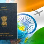
The map was initially shared by the USTR as part of an update on the interim trade framework agreement between India and the United States. Under this framework, Washington has agreed to roll back punitive tariffs that it had previously imposed on Indian goods, reducing **import duties from around 50 percent to a more favourable 18 percent, which is the lowest rate the U.S. has extended to any Asian country. At the same time, India is expected to reduce reciprocal tariffs on certain U.S. products. These tariff cuts are designed to boost bilateral trade and serve as a stepping stone toward a more comprehensive trade deal between the two major economies.
Because the map was tied to a high-profile trade announcement, many in India and abroad believed its inclusion in the post was a deliberate diplomatic gesture, reflecting a warming of India-US relations and possibly a signal of U.S. support for India’s territorial stance. Some analysts went as far as to suggest it was a carefully calibrated message amid broader geopolitical shifts, particularly given intensifying rivalry with China and evolving regional dynamics in South Asia.
Removal of the Map: End of Speculation, Start of Questions
Despite the initial buzz, the USTR removed the map post entirely from its official X account just days later, without issuing any formal explanation or statement. This abrupt deletion has effectively ended the immediate controversy, even as political and diplomatic discussions continue. No official reason was given by the USTR, the U.S. State Department, or the White House, leaving analysts and commentators to speculate on the motive behind both the map’s original posting and its subsequent removal.
Observers have offered several possible interpretations. Some believe the map’s posting was an unintended cartographic oversight or a technical error that did not go through the usual inter-agency review processes. Others think it might have reflected internal differences within the U.S. government on how to communicate territorial representations on foreign soil during sensitive negotiations. Yet another line of analysis points to the possible diplomatic pressure from Pakistan or China, who object strongly to any implication that contentious territories belong to India, noting that any U.S. depiction carries significant geopolitical weight. Reports suggest that Pakistan may have lodged objections via its embassy and diplomatic channels, though official confirmations are limited.
Neither the USTR nor U.S. officials have publicly addressed the diplomatic debate, and the removal of the map without explanation leaves room for varied interpretations. Regardless of intent, the incident underscores how even visual representations — like maps — can carry powerful political meaning and can quickly become flashpoints in international relations.
India’s Official Position on Territorial Integrity
New Delhi has long stood firm on its claims to territories such as Jammu and Kashmir and Aksai Chin, emphasizing historical treaties, legal foundations, and constitutional assertions. The Indian Ministry of External Affairs (MEA) often issues formal protests when foreign governments or international agencies publish maps that do not align with India’s official territorial view, a practice India considers disrespectful to its sovereignty. The current episode is consistent with this pattern of objection, as India’s position on borders remains non-negotiable in its diplomatic engagement.
For New Delhi, how other countries depict its borders is not merely a cartographic detail but a matter of national dignity and international law. Indian diplomats and policymakers have argued that accurate maps should reflect their country’s understanding of territorial boundaries, especially in official communications and public documents.
Broader Geopolitical Implications and Future Outlook
The map controversy comes at a time when India and the United States are actively strengthening economic and strategic ties, including cooperation on trade, investment, defence, and regional security. The interim trade framework agreement represents a significant step toward deeper economic integration and mutual benefit, following a period of tariff tensions and negotiation challenges. However, the swift removal of the map illustrates the complex diplomatic balancing act involved when cartographic imagery intersects with sensitive geopolitical issues.
Moving forward, both countries may want to avoid similar controversies by standardising the mapping protocols they use in official communications, especially where territorial disputes are concerned. The episode also highlights the importance of diplomatic communication strategies and the need for careful review when visual elements, like national maps, are shared on high-visibility platforms.
In the end, while the map gained global attention briefly, its removal has quieted immediate debate. What remains clear is that territorial representations, especially in contentious regions like PoK and Aksai Chin, continue to be deeply entwined with national identity, diplomacy, and international relations.
Related posts:
 India Releases Translated Constitution Versions as Nation Celebrates Samvidhan Divas
 India and Afghanistan’s Historic Border Connection Through Wakhan Corridor
 AI Chatbots Tricked by Adversarial Poetry in Shocking Jailbreak Discovery
 Pakistan’s Asim Munir War Rhetoric Sparks India-Pakistan Tension
 Telangana names road “Donald Trump Avenue” near US Consulate
 Virologist Li-Meng Yan fears China luring her back to silence
 Assam CM on Voter Ideology, Demographic Debate, and Election Politics
 Rebuilding Jackson Gate in Agartala: Restoring Tripura’s Royal Heritage
 Why Indians Are Giving Up Citizenship In Record Numbers
 BSF Jawan Taken Across India-Bangladesh Border Amid Smuggling Incident